Texture shading is a new technique for generating shaded relief images to show the three-dimensional structure of mountainous terrain. It differs from traditional hillshading and can be used either as an alternative shading method, or as an enhancement to hillshading by combining the two methods. Texture shading emphasizes the drainage network (canyons and ridges) of the landscape and exhibits a visual hierarchy that reflects this structure. It can be used to bring out fine details that are present in high-quality elevation data, and likewise as a tool to examine digital elevation models for unwanted data artifacts.
*** NEW *** An experimental website is now available to run the texture shading algorithm, without having to download or install any software. Simply upload your terrain data files, set the parameters as desired, and download the resulting georeferenced image file. This online version can be accessed at the link below:
http://sipgcloud.isr.ist.utl.pt:4860/
A more detailed description of texture shading and the algorithm behind it is given in this paper from the 9th ICA Mountain Cartography Workshop, as well as two PDF slide presentations available at box.com/textureshading/. That site also contains free command-line programs for both Mac and Windows to perform the computation, along with complete source code. For a more user-friendly program, Natural Scene Designer 7.0, which is available from Natural Graphics, includes the ability to do texture shading, based on the same algorithm. Both Mac and Windows versions are available.
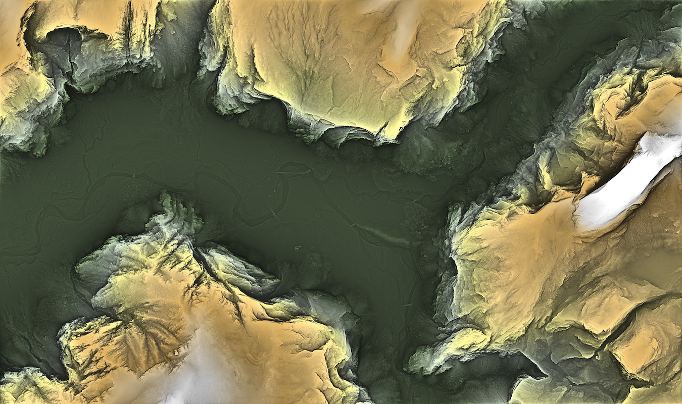
The image example above is an orthographic (top-down) view of eastern Yosemite Valley generated with texture shading using Natural Scene Designer. Note the large dynamic range of terrain features visible on this map – from the 2000-foot vertical face of Half Dome (at the right) to the banks of the Merced River in the valley, which are only a few feet high. Click here to view or download the full-resolution version of this image (large file – 42 MB).
For another perspective on texture shading and some additional examples, see Tom Patterson’s article on the topic at www.shadedrelief.com/texture_shading/.
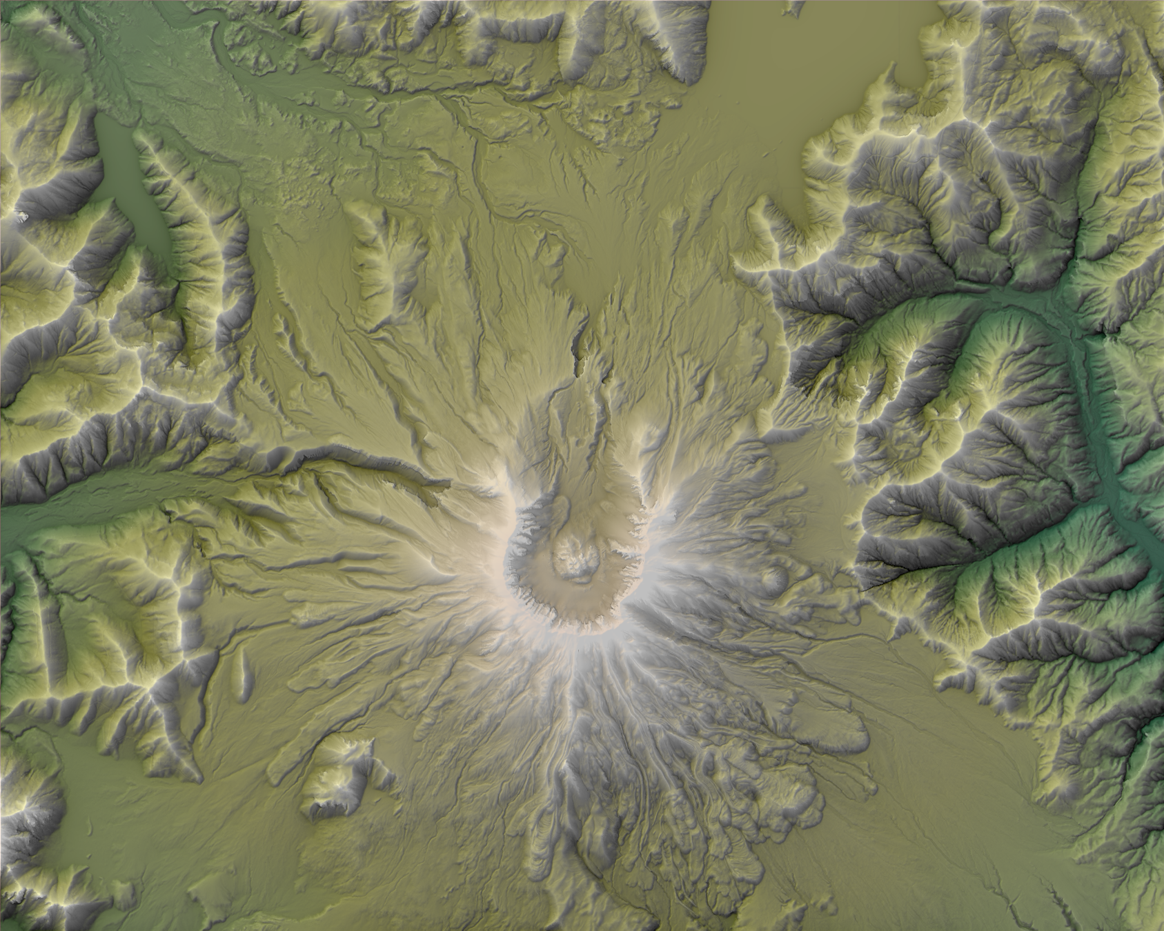
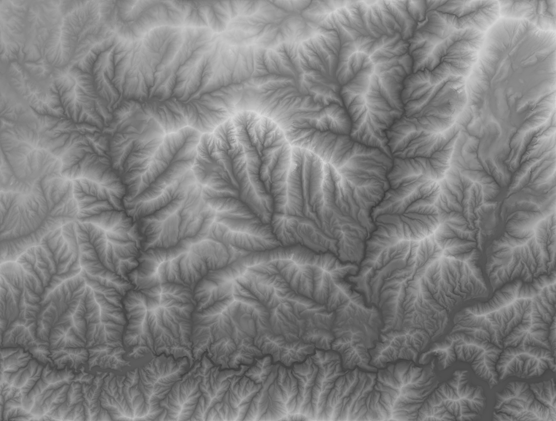
Below are two more examples. The first shows Mt. St. Helens, using a mix of texture shading and standard hillshading, and colored according to elevation. The second shows the San Gabriel Wilderness and surrounding region near Los Angeles, using texture shading alone. Click on the images to view or download higher resolution versions.